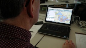
 Fishwerks was developed with input from the U.S. Fish and Wildlife Service to potentially change the way decisions are made about barrier removal in fish habitat. In the past, limited information forced agencies to prioritize barrier removals in simplistic and, in many cases, inefficient ways. Because of such limitations, cumulative passability could not be fully considered in barrier removal decisions. Users can view the barriers overlaid on a Google map and apply filters to barrier attributes like passability and removal cost to visualize subsets of the data. But data visualization is only the beginning.